
As Victorian railway engineers pushed north through Scotland, they encountered two significant obstacles – the Firth of Forth and the estuary of the River Tay, challenging river crossing lying to the south and north of the Kingdom of Fife that, until the late 1870s and early 1880, were the preserve of ferries. Carrying railways over these broad river mouths would be a task in itself – one vital to the speedy and efficient running of the railways – and it was one that ultimately fell to the Edinburgh & Northern Railway Company and North British Railway Company.
In 1878, the Edinburgh & Northern Railway successfully bridged the River Tay with a two-mile long, 85-span structure, then the longest bridge in the world. Spanning the River Forth would be a shorter but no less demanding challenge and one that, at that point, had been in the pipeline for decades. Engineers were, however, struggling to find solid rock below the riverbed on which to mount a bridge.
After creating a very successful roll on, roll off ferry service between Granton and Burntisland, engineer and designer of the Tay Rail Bridge, Sir Thomas Bouch began working on plans for a suspension bridge across the Forth in the 1860s. He was not the first to investigate the possibility; in 1806 proposals were drawn up by Taylor & Vazie for a tunnel – through which a cart track was proposed – under the river and, in 1818, James Anderson designed a three-span suspension bridge located close to the site of the present Forth Rail Bridge.
Bouch continued to beaver away on his proposals, carrying out detailed investigations of the riverbed during the 1860s.but by 1867 the North British Railway was tettering on the verge of bankruptcy and all work ceased. It was not long, however, before the desire to bridge the Forth resurfaced and, in 1871, Bouch proposed a stiffened steel suspension bridge. Seven years later, work started on the project and a foundation stone was laid close to the island of Inch Garvie.
However, the collapse of the Tay Railway Bridge during a fierce storm on the night of December 28, 1879, with the loss of a North British train and all 75 souls aboard swiftly ended Bouch’s involvement with the Forth crossing. Knighted by Queen Victoria for his work on the Tay crossing but found ‘mainly to blame’ for the bridge’s failure at a public inquiry, his plans for the Forth were officially abandoned in January 1881. He died, a broken man, shortly after.
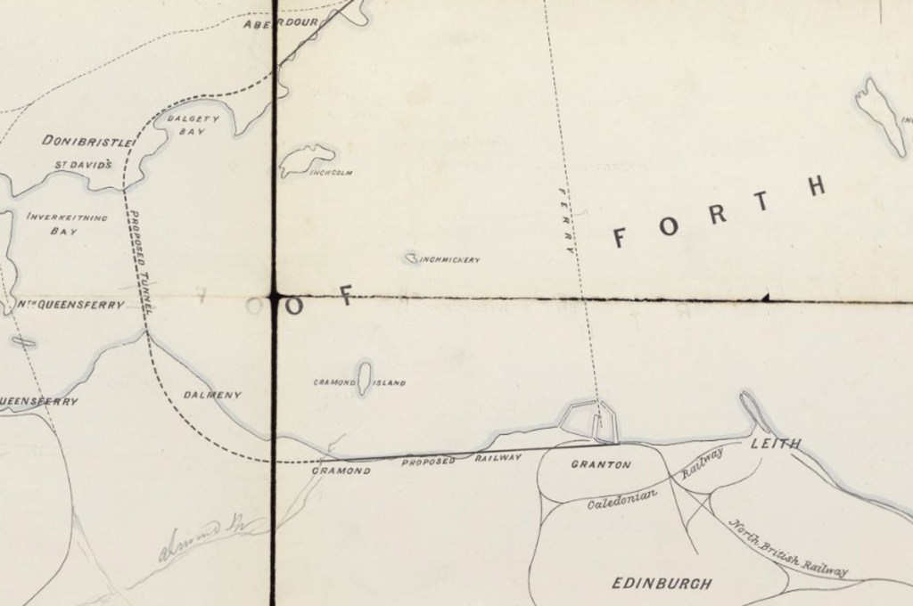
Peck’s map of the proposed tunnel (National Library of Scotland)
In the intervening period, proposals for a railway tunnel under the Forth were mooted, seen by some perhaps as a safer alternative to a bridge in light of the Tay Bridge Disaster. The only surviving paperwork relating to the proposal is a map with cross sections drawn up by J Peck, of Glasgow, in 1880. It has been preserved at the National Library of Scotland, in Edinburgh. The map shows a coastal railway linking with the North British Railway and Caledonian Railway in Granton, Edinburgh, running west to Crammond, where the southern end of the tunnel was to be located.
Proceeding west initially before curving north, the tunnel passed below Dalmeny, descending at a gradient of 1 in 75 for 4723 yards. Below Hound Point, where a shaft would be sunk, it proceeded north under the river, flattening off briefly before beginning the 1 in 75 gradient climb. Another shaft was to be located on the north side of the river.
Passing below Downing Point, on the Fife coast, the railway remained underground as it tunnelled under Donibristle and curved around Dalgety Bay before emerging once again after a 4047 yard incline at Aberdour from where the North British Railway continued north overland to Perth and Dundee. In all, the proposed tunnel was 11770 yards, or six and a half miles, in length.
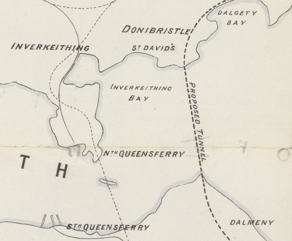
Peck’s map of the proposed tunnel (National Library of Scotland)
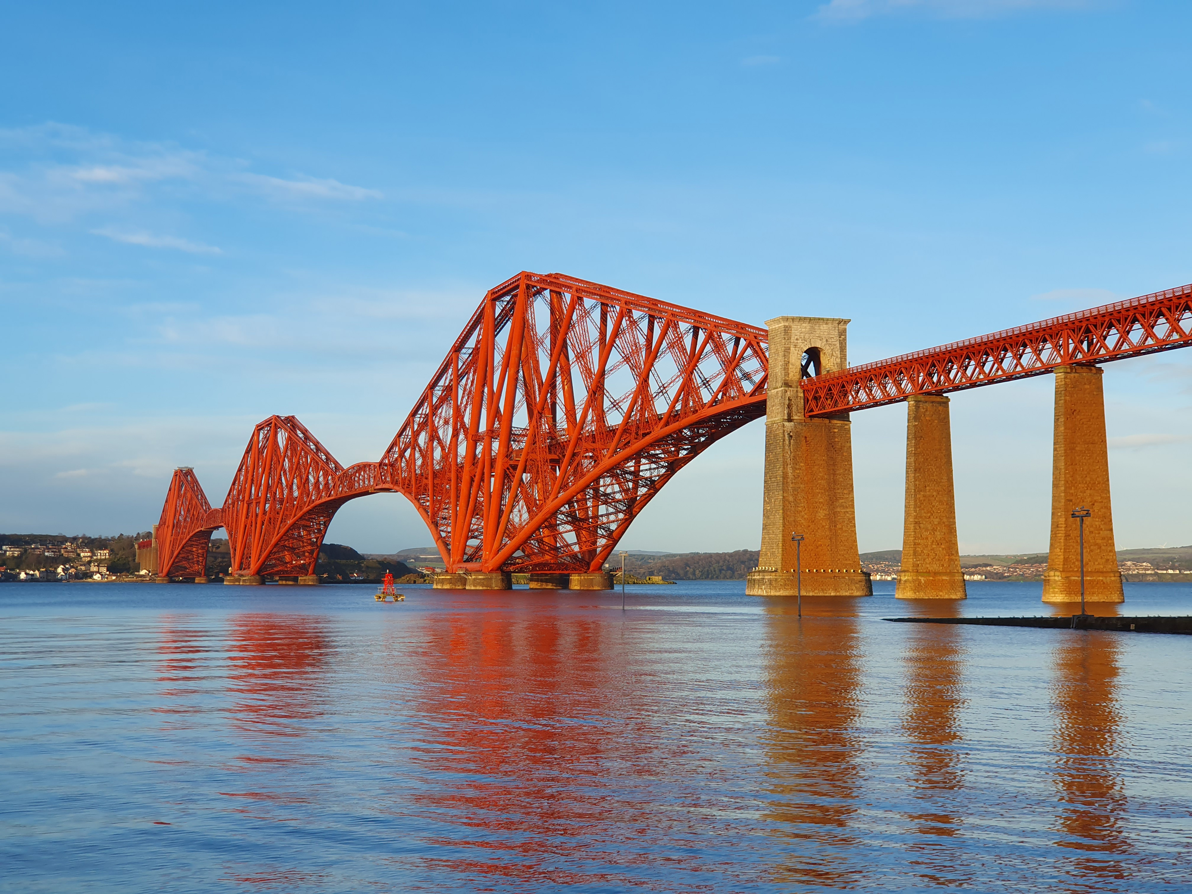
Sadly, there is no record of whether or not this proposal was seriously considered. However, after firing Bouch, the North British Railway did no go down the route of a tunnel and proceeded instead with another bridge design, the spectacular cantilever one that stands to this day. Completed in 1890, it was designed by engineers Sir John Fowler and Sir Benjamin Baker and built by Sir William Arrol & Company. Arrol also constructed a replacement rail bridge over the Tay, designed by William Barlow and opened to traffic in July 1887.
Plans to tunnel under the Forth surface from time to time and there existed at least one subterranean walkway beneath the river. Created in 1964, the tunnel linked Valleyfield Colliery, at Culross, in Fife, with the Kinneil coal mines of Bo’ness, in West Lothian, and was used to convey coal south to a modern processing plant. It shut in 1982 following the decline and final closure of the collieries.
More recently, the Scottish Green Party proposed a £6 billion railway tunnel under the Forth Estuary, running from Abbeyhill, Edinburgh, north to Seafield, on the Fife coast near Kirkcaldy. Descending below Leith, the project was designed to ease the bottleneck around Edinburgh’s Haymarket Station, which it was said impacted upon the ‘whole network’. Experts deemed the idea feasible but expensive.
If you have enjoyed this post, and others on the site, you might like to buy me a coffee which helps support the site and funds new content… Or visit my Kofi page.


