
In an earlier post, I described my exploration of the military remains of the First World War battery at Braefoot Point, in Fife. This time, heading north along the coastline, and remaining on the point, I hopped across the tanker terminal, to visit Charles Hill where there are renmants of three distinct phases of human occupation – a medieval ferry house and store known as Monks’ Cave and the sites of a Second World War camp and a coastal defence battery. All three occupy a mushroom-shaped peninsula jutting into the waters of the River Forth.
Once again, I began my wanderings in Aberdour, about a mile and half away, walking west along High Street before leaving the busy thoroughfare at Donibristle Gates, entrance to the former Donibristle Estate, to join the Fife Coastal Path. The waymarked trail skirts along the top of a golf course, entering woodland where gaps in the shrubbery revealed a view south across the Forth to the island of Inchcolm, home to 12th century Inchcolm Abbey and a variety of wartime fortifications intrinsically linked with Charles Hill.
Hiking on past the wooded policies of St Colme House, I met the access road to Braefoot Bay Marine Terminal which cuts across the coastal path. Turning left here, I followed the road down towards the terminal, branching left at the main gate, passing through a car park to join a track which, beyond a gate, cuts across a corner of the golf course and proceeds over grazing land – where the camp was located – towards the surviving military ruins. The land belongs to Shell UK and visitors are asked to call at the terminal gatehouse before proceeding down.
The track follows the line of the old camp road east towards the shoreline, ending at an area of hard-standing, once a turning circle. Ahead are the remains of the old battery which, in summer, can often be difficult to access due to the undergrowth, with brambles particularly prevailent, although concrete stairways survive, offering fairly clear links between the various parts of the Second World War site.
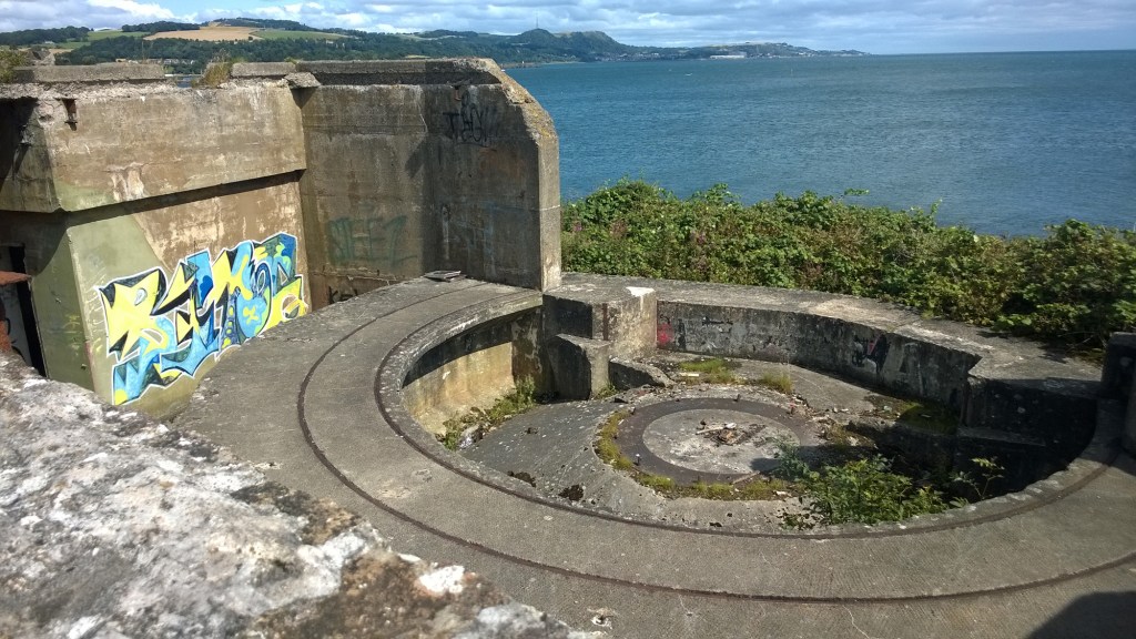
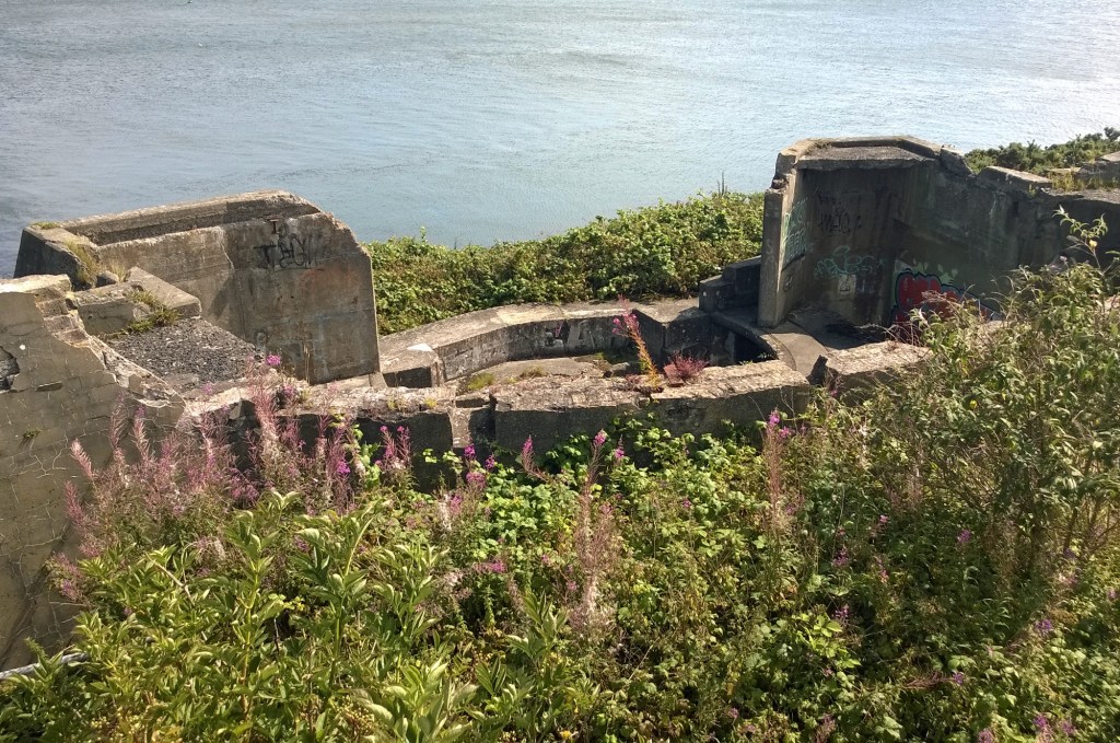
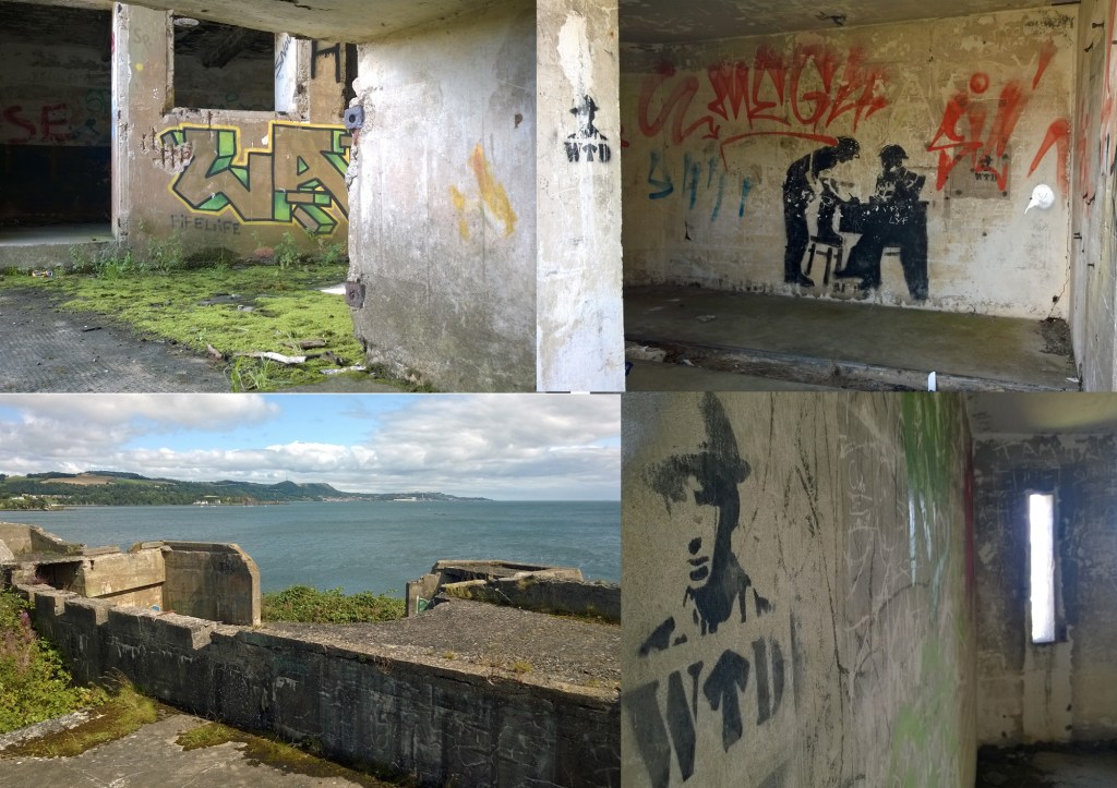
At the top of the site are the remnants of an old magazine, on the right, and stores, to the left. There was also a control tower and toilet block here, but both were demolished. Steps lead down to the hefty concrete form of the twin six-pound gun emplacement, flanked by a gun store and crew shelter. While the canopy and steel shield which once protected the gun and its crew have long since gone, the reinforced concrete base and walls remain solid, although there is a fair bit of graffiti now.
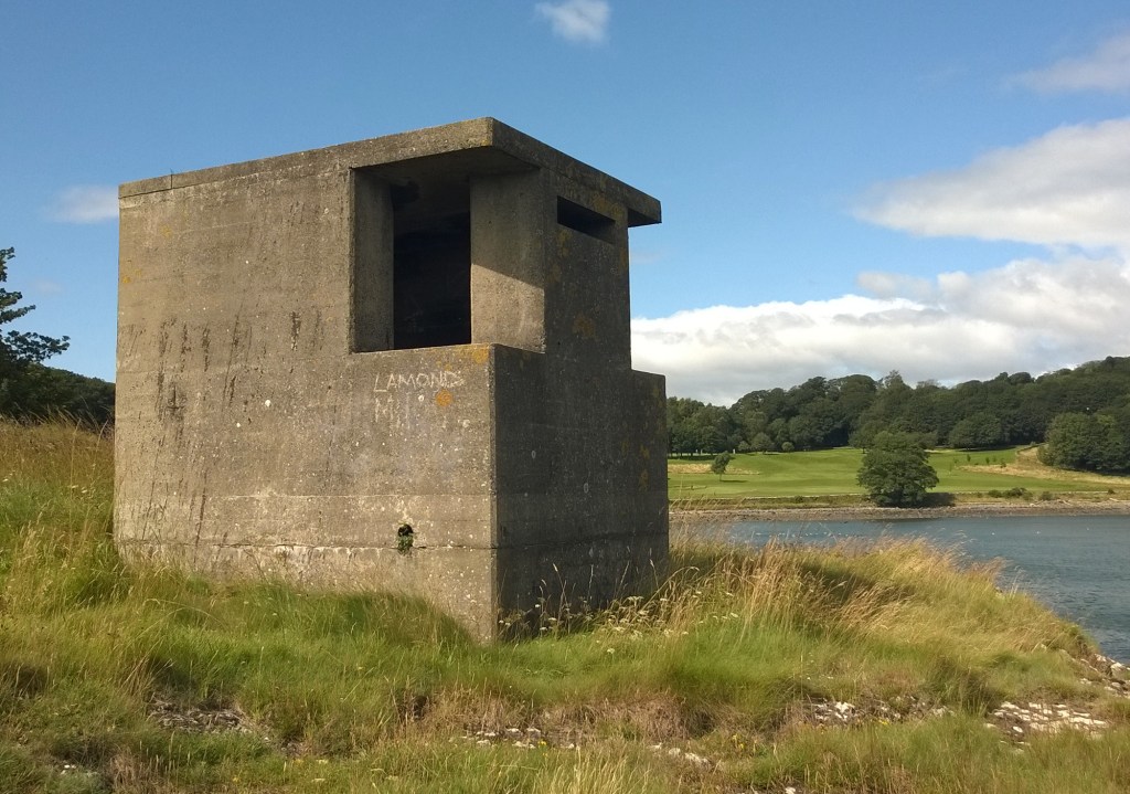
A short walk north of this complex, there is a small concrete observation post overlooking the bay, where a Lyon Light was located. When the battery was operation, a field gun – to protect the camp – and auxilliary engine house occupied the slope above. It is a fascinating place to explore, dipping in and out of the various bunkers. Metal rails on which the gun rotated, and the stump where it was mounted to the base remain.
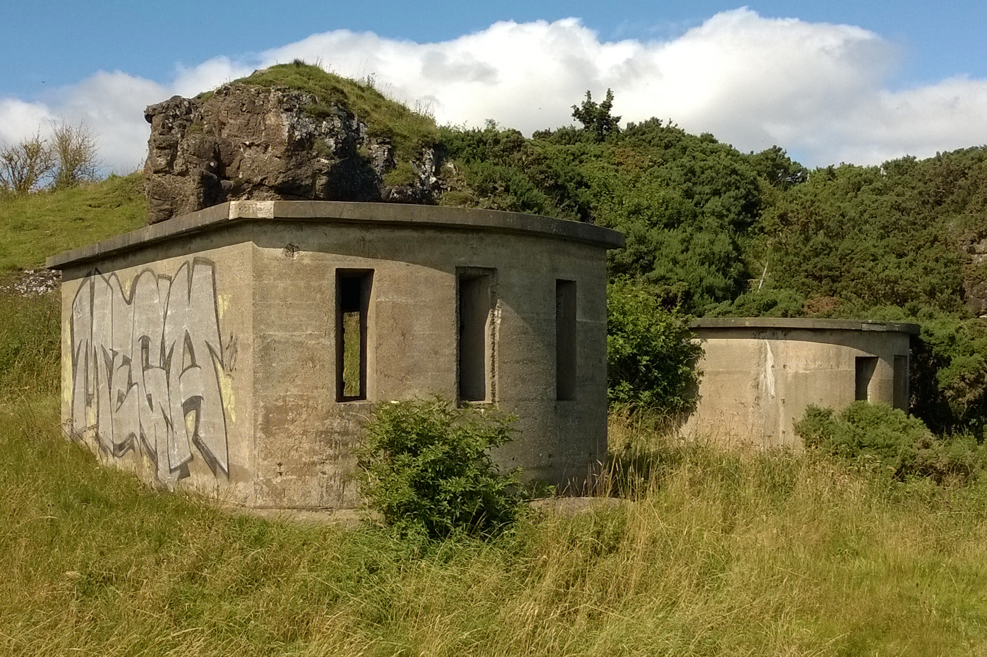
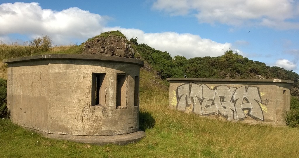
To the south of the gun emplacement, there was a trio of search light posts sheltered by low crags. The concrete buildings remain and are easily accessible, despite encroaching gorse.
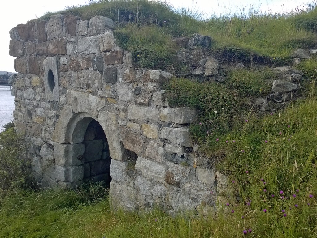
Proceed further south along the coastline from here and the next structure encountered is the ancient Monks’ Cave, set into a steeper grassy mound. It is a bit of a scramble up the slope, over rocky ledges, to the arched stone entrance which leads into a low vaulted cellar-type chamber.
Constructed by the monks of Inchcolm Abbey during the medieval period, the dressed stone doorway is believed to date from the 15th century. Inchcolm lies about half a mile offshore and the cave served as a ferry house and store for men and goods heading to and from the island abbey. There was originally another storey above the vaulted cellar but it has been lost to the passage of time.
Inchcolm itself is worth a visit, both for its abbey and wartime remains, but it is only accessible from the south side of the Forth, a ferry – Maid of the Forth – making the crossing from South Queensferry during the summer months.
During the Second World War, concrete steps were added to make access easier and the old cavevwas pressed back into service as a store for munitions. On the foreshore below, a line of pillars projecting seaward are the northern end of an anti-submarine boom laid across the River Forth during the First World War. It projected over Mortimer’s Deep to Inchcolm then continued south to Crammond Island, on the other side of the estuary.
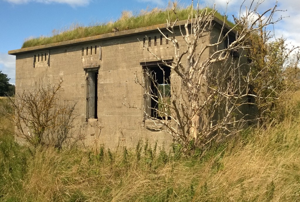
Charles Hill was first developed for military use in the 1930s, prior to the outbreak of the Second World War. A small military camp was erected in the latter years of the decade, initially intended as a training base for divisions assigned to the coastal defences on the islands in the River Forth. Completed in 1939, it consisted of an officers mess and quarters, range and training hut, canteen, engine room, barracks, office, guardhouse and stores, and could accommodate 90 men. Located between Braefoot Bay, to the south, and Barnhill Bay, to the north, it was protected from landward attack by a fence strung across the peninsula to the west. Most of the buildings were wooden or corrugated iron huts while the engine room, the only structure still standing, was a more robust brick and concrete building.
At the outbreak of war, the camp adopted a more significant role as the northern-most site on the inner defence line of gun batteries and search lights protecting the Forth Estuary and as the northern landfall of booms and nets strung across the river to detect and block enemy torpedoes or submarines. In June 1940, the searchlights and gun-emplacement, equipped with the only example of a twin six-pounder gun on the Scottish mainland, were complete and ready for use. There were similar guns on the islands of Inchcolm, Inchmickery and Crammond, also part of the inner defence line. With a range of 5000 metres, they were designed to rain down rapid fire upon any smaller, faster enemy boats that managed to make it past the outer lines of defence.
As the war progressed, and with the invasion of Britain appearing less likely, troop numbers manning the coastal defences were gradually reduced. In 1943, the army camp at Charles Hill provided a land base for troops assigned to Inchmickery who would spend two weeks on the island and one week on the mainland. By 1945, Charles Hill ended the conflict having never come under seaborne or landward attack. While the army camp was removed, the gun and searchlights remained in place until 1956, manned on a care and maintenance basis until they too were finally decommissioned, ending the military connection with this corner of the Fife coastline.
Today, sitting between the First World War ruins of Braefoot Point, to the south, and the Second World War remains of Charles Hill, the Braefoot Bay Marine Terminal opened in 1984. Operated jointly by Shell and Exxon Mobil, and equipped with a two spur jetty and storage tanks, it loads liquefied petroleum gas on to tankers bound for Europe and the USA. The gas, originally from the North Sea, arrives via pipeline from Mossmorran, in Fife, four miles inland.
If you have enjoyed this post, and others on the site, you might like to buy me a coffee which helps supports the site and funds new content…


1 Comment